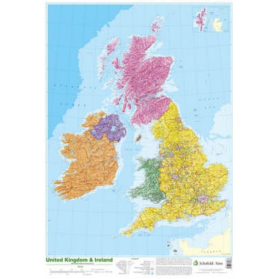
This detailed relief map of the United Kingdom and Ireland is colour coded to show the area of each country and large city. County boundaries are marked, as are rivers, motorways, ports and airports. An explanation of the political relationship between the countries is given, alongside information about the distance from sea level to Ben Nevis.
Ταξιδιωτικοί χάρτες, Ηνωμένο Βασίλειο, Μεγάλη Βρετανία, Παιδική/Εφηβική : βιβλία αναφοράς: άτλαντες και χάρτες, Γραφική ύλη και διάφορα είδη για παιδιά / εφήβους, Ιρλανδία
Καλή ποιότητα χαρτιού, δείχνει με ευκρίνεια τα μέρη του Η.Β. , ιδανικός για την αίθουσα Αγγλικών στο σχολείο μου! Ακριβός, όμως, σε σχέση με το μέγεθός του!